18
Reference
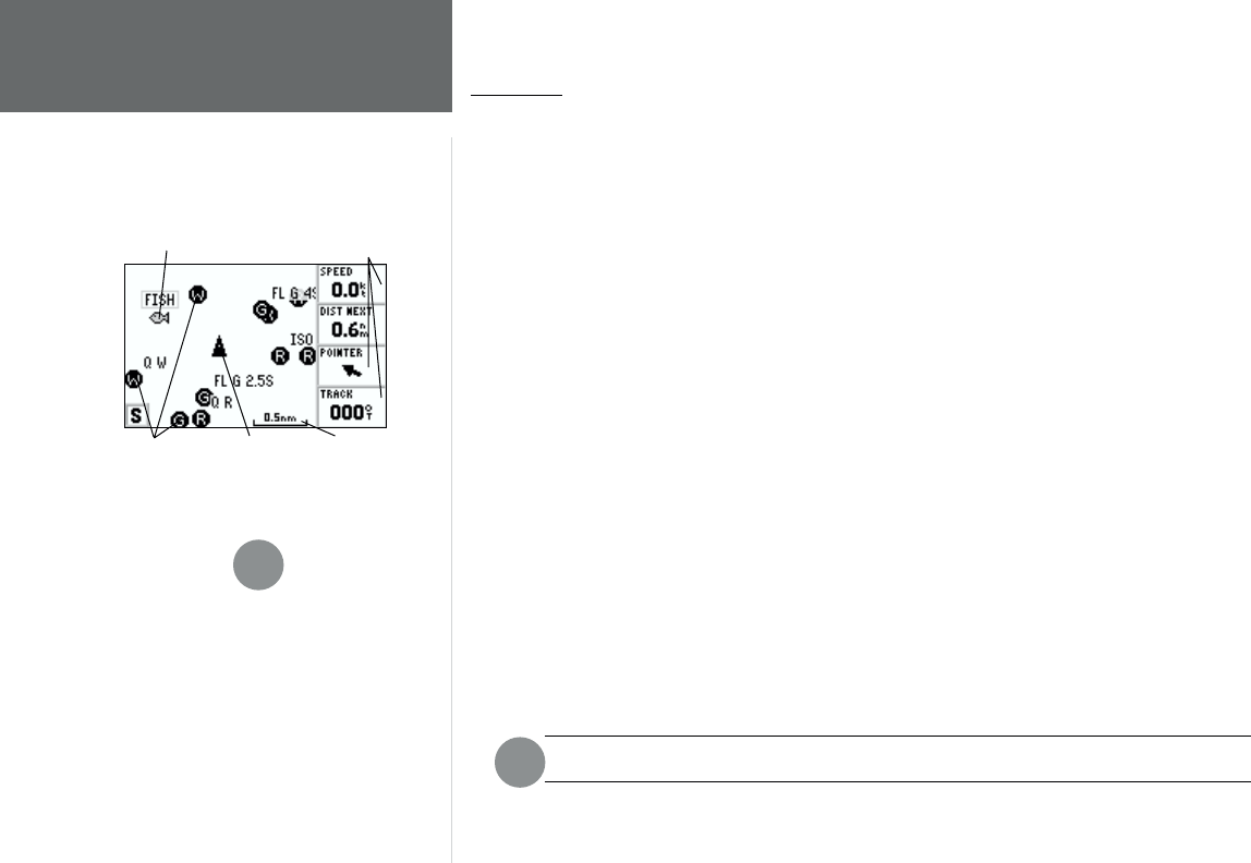
Map Page
Map Page
The GPS 152’s Map Page provides a display of plotting and navigational data. The unit is preloaded
from the factory with a worldwide database of cities greater than 200,000 in population and marine
navaids, for the Americas only. It also plots your track and displays any routes and waypoints you create.
An on-screen cursor lets you pan and scroll to other map areas, determine the distance and bearing to a
position, and perform various route and waypoint functions.
When the cursor is active, an additional data window will appear below the data fi elds to indicate
the position, range and bearing to the cursor or a selected waypoint or map item. The map scale displays
at the bottom right of the map window.
The IN and OUT keys, combined with the ARROW KEYPAD, let you select zoom ranges and move
the cursor. Two basic map operating modes, position mode and cursor mode, determine what is shown
on the map display. Position mode pans the map to keep the present position marker within the display
area, while cursor mode pans the map to keep the cursor within the display area.
The GPS system will always power up in the position mode, with your vessel centered on the
map display.
When the ARROW KEYPAD is pressed, the GPS 152 will enter cursor mode. In cursor mode:
• The cursor can be moved over the map display using the ARROW KEYPAD.
• Whenever the cursor reaches the edge of the display, the map will scroll forward under the cursor.
Keep in mind that the boat icon will move with the map scrolling and may go off the display screen
(you may not be able to see your present position).
• When the cursor is stationary, a fi xed coordinate position will appear in the position fi eld. Note that
the distance and bearing will change as the boat’s position changes.
• Whenever you zoom in cursor mode, the cursor will be centered on screen.
• To return to position mode, press the QUIT key.
When the cursor reaches the edge of the map, the unit may pause as it loads new data.
F
Data Fields
Boat Icon
Map ScaleNavaids
User Waypoint
Map Page
I
If MapSource POIs or MapSource products are
loaded into the unit, the tides, cities and marine
navaids will be deleted from the system. Check the
GARMIN web site (www.garmin.com) for updates
to reinstall the original factory-loaded data.