TPS400 Mining Manual-1.0.0en
Grades
17
Grades
Mining_z04
Introduction
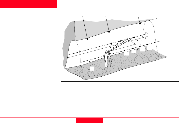
"Grades" application is used to
mark gradelines along the side
walls of the mines (tunnels). It
allows users to input the slope
gradient and an offset
concerning the grade point. It
computes the stake out height
difference. The program allows
also to map the positions of the
grades points along the
gradelines.
Known:
• Coordinates and grade
elevation of station
• Coordinates and grade
elevation of backsight point
• Slope gradient (station until
foresight point)
• Height difference (dH)
between current gradeline
and new gradeline
Unknown:
• Stake out height difference
(dHgt) between measure
point and gradeline point
• Horizontal distance (dHD)
along the foresight line
Backsight Point Station Foresight Point
New Gradeline
dH
1
2
3
4
H = Current height of
gradeline above mine floor
dH = New height difference
input for new gradeline
dHD
1A
2A
3A
4A
H
H


