


119
Non-Radio Location Based GPS Features
When connected to a GPS, you can program specific location information which will
trigger an alert from the scanner. The following geographically based values are
typical of the use you might find valuable while traveling. Use the menu to input the
necessary data to enable each.
Dangerous Xing — Stores location, and direction of travel. If you are in
range, traveling in a direction that will take you to that Point, the radio
sounds an alert at .5, .25, and .1 miles from the point.
Dangerous Road — Stores location, direction of travel, and speed. If you are
traveling at a speed greater than that specified and if you are within range of
the set location, the scanner sounds an alert at .5, .25, and .1 miles from the
point.
Points of Interest (POI) — Stores location and range. If you approach the set
location, the radio sounds an alert.
In general, an alert based on location is comprised of the following data:
Latitude
Longitude
Speed (optional setting)
Name (optional setting)
Alert Type and Sound level (optional setting)
Direction (optional setting)
There are four setting conditions that can be set to result in alerts:
A speed setting greater than zero with no direction entered. This results in
an alert based only on speed in any direction.
A speed setting grater than zero with a specific direction entered. This
triggers an alert when the speed is exceeded but only in the specified
direction.
Speed is equal to zero and a direction is entered along with a location. This
setting is used for a dangerous intersection alert.
Speed is set to zero and no direction is entered but only location. This is a
point of interest alert.
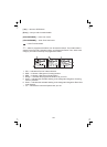
By pressing you can next choose from a setting for Speed,
Intersection, or Point of Interest.
!
!
!
!
!
!
!
!
!
!
!
!
!
+ [GPS]