


22 Rino
®
110 Owner’s Manual
UNIT OPERATION > MAP PAGE
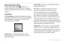
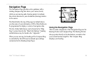
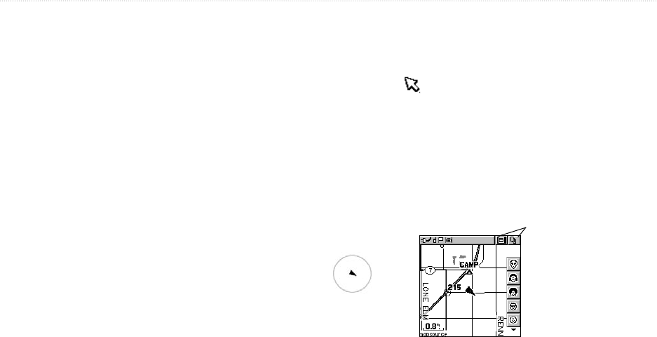
Map Page
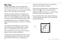
The Map Page displays your present position and
direction of movement using a triangular Position Icon
that is centered on the map. As you travel the map display
leaves a “trail” (track log) of your movements.
The map can display a higher level of detail than the
basemap provided with the unit (i.e. residential streets,
parks, etc.), if Garmin MapSource data has been loaded
into the unit using a CD-ROM mapping program. When
using MapSource data, the word “mapsource” displays
below the map scale whenever you zoom in to view map
details.
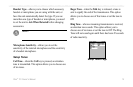
On the right side of the Map Page, you can choose to
show either the Contact Bar, Data Fields, or only the
Map. As you highlight the contacts on the Contact
Bar, the Map Page centers the map on that contact and
displays its name, direction, and distance.
In many instances the map displays an Accuracy Circle
surrounding the Position Icon. The Rino 110 uses both
map resolution and GPS accuracy in defining your
location to a point within the circle. The smaller the
circle, the more accurate your location.
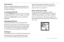
When using the Pan Map feature, a small outline arrow
(Map Pointer) can be moved about the page to
highlight and identify map items or to scroll the map to
view areas not shown on the display screen.
Four optional data fields on the right side of the page
can be programmed to provide a variety of travel and
navigation information.
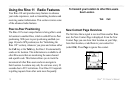
Accuracy Circle
Status Bar
Option Menu and Main
Page Menu Buttons
Position Icon
Map Scale
Contact Bar