


82
Using GPS/Displaying Maps
Using GPS/Displaying Maps
Starting GPS Data Recording
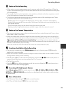
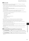
The camera’s internal GPS receives signals from GPS satellites and identifies its
current time and position.
The position information (latitude and longitude) can be recorded on the pictures
to be shot.
Turn the GPS Functions On
Set Time zone and date (A94) correctly before using the GPS function.
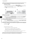
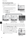
1 Use the multi selector to select Record GPS
data, and then press the k button.
2 Select On and press the k button.
• Signals are received from the GPS satellites and
positioning starts.
• The default setting is Off.
3 Press the d button.
• The camera returns to shooting screen.
• Operate in an open-air area when starting to receive signals from GPS satellites.
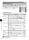
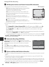
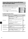
Press the d button M z (GPS options) menu icon (A9) M GPS options
Erase GPS data
Update A-GPS le
Record GPS data
GPS options
O
On
Record GPS data