


88
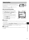
Using GPS/Displaying Maps
Features That Can Be Set Using the d (Menu)
Button (GPS Options Menu)
From the menu screen, select the z menu icon to
display the GPS options menu, and then you can
change the following settings.
• The GPS options menu can be displayed also by
pressing the d button while the map is displayed.
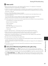
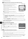
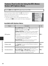
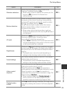
Available GPS Options Menu
Press the d button Mz (GPS options) menu icon (A9)
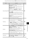
Option Description A
GPS options
Record GPS data: When set to On, signals are being
received from the GPS satellites and positioning starts
(A82). The default setting is Off.
Update A-GPS file: A memory card is used to update
the A-GPS (assist GPS) file. Using the latest A-GPS file
can shorten the time needed for tracking the position
information.
• Download the latest A-GPS file from the website
below, and use it to update the file.
http://nikonimglib.com/agps3/
Erase GPS data: The position information and POI
information recorded on pictures are erased.
E58
Distance units
The distance units of the map display can be selected
from km (m) (kilometers (meters)) (default setting) or
mi (yd) (miles (yards)).
E59
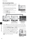
Calculate distance
Calculate the linear distance from the current location
to the shooting location on the image (only when
Record GPS data of GPS options of the GPS options
menu is set to On) or between image shooting
locations (only when using playback mode).
E60
View log
Create log
Points of interest (POI)
Calculate distance
Distance units
Synchronize
GPS options