


85
Using GPS/Displaying Maps
Displaying Maps
The current position or image shooting location can
be displayed on the screen using the camera’s internal
map information.
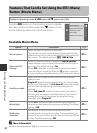
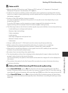
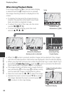
To display the map, press the U (map) button in
shooting mode or playback mode.
When Using Shooting Mode
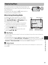
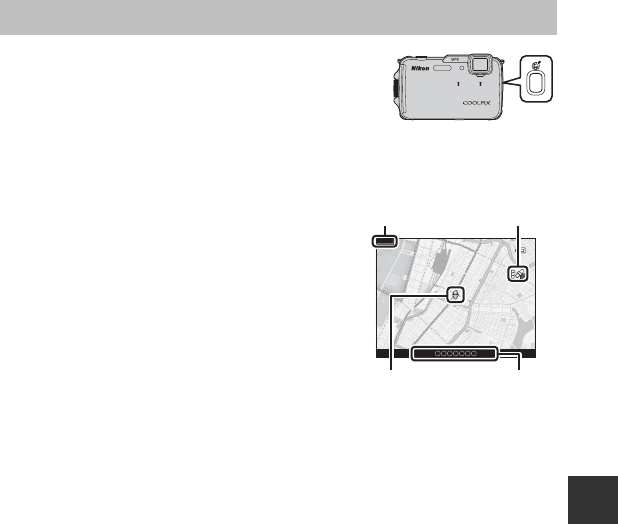
To display the current position on the screen,
press the U (map) button in shooting mode
when Record GPS data in GPS options of the
GPS options menu is set to On.
• To display the current position, the position
information must be obtained in advance.
• To adjust the scale of the map, use the zoom
control (f (h)/g (i)).
• To move the map display, press the multi
selector H, I, J or K.
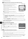
B Map Display
• The map display cannot be rotated. Only the north up display (the top of the screen indicates the
north) is available.
• The map display scale may vary depending on the country where the map is displayed.
• In shooting mode, when Record GPS data in GPS options of the GPS options menu is set to Off
or when positioning could not be performed, a world map centered on the region that was set in
Time zone of Time zone and date in the setup menu (A94) is displayed.
C Action Control
When the V (action) button is pressed, the current location can be displayed on a map by action
control (A7).
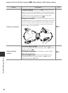
500m
Scale
GPS reception
Current
position
Location name
information (A84)