124
4 Set Heading JF You can input the compass direction to the site from your
present location or, you can select All Range which ignores your specific
heading.
For example: If the Dangerous Road location is toward the Northeast and you are
driving in that direction, then choose NE (45°)
If you know you will be driving on a road which has many curves to that site center,
choose All Range which will trigger the alert regardless of direction as long as
the other requirements (range, speed) are met.
If you travel in a Northeast direction and do not travel either side of a northeast line
by up to 22 degrees, the alert system will function.
4 Set Speed Limit JF Choose from 0, through 100 MPH in 5 MPH steps or
the equivalent in KPH for metric usage.
Deleting a Location
If you have programmed a location that you no longer want, you can delete it as
follows.
[MENU]
J Program Location JF
4 Select a location such as Dangerous Xing JF
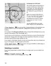
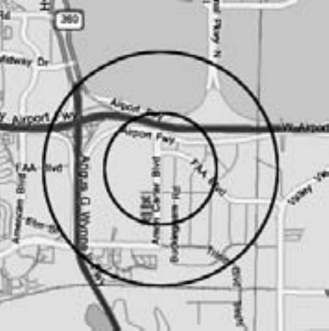
An Example of a POI Alert
The Uniden America Corporation is
located at 4700 Amon Carter Blvd
in Ft. Worth, TX. The Latitude and
Longitude of the front entrance is
32° 50’00.63” N and 97°02’54.16”
W.
When you program that data as a
POI, you can select alert ranges of
.1, .25, .5, .75, 1.0, 1.5, and 2.0
mile distances to the POI. Shown
on the map are .5 and 1.0 mile
markers.
You are alerted when you come
within range of your set distances.


