124
[.No] — returns to GPS Mode.
[E
YES] — lets you edit a location details
[SCAN/SEARCH] — enter scan mode.
[HOLD/RESUME] — enter Scan Hold mode
— enter Function Mode.
— select a programmed location from all stored locations. The location data is
stored in the order POI, Dangerous Xing, and Dangerous Road. Then, within each
category, the data is stored by the programmed name.
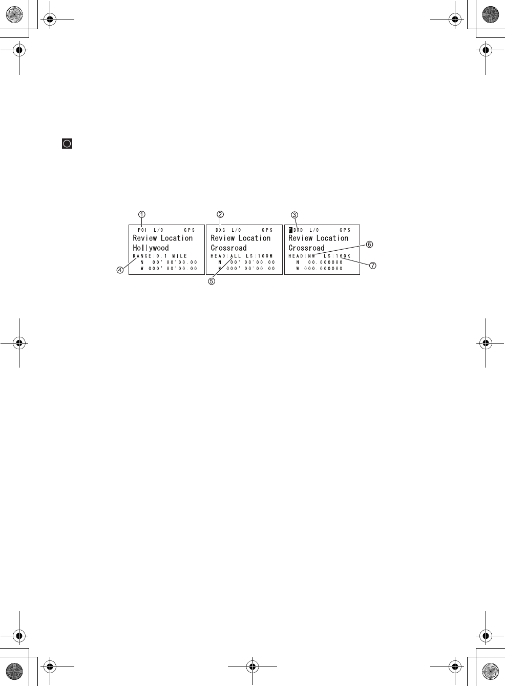
1. POI — Indicates a Point of Interest location.
2. DXG — Indicates a Dangerous Crossing location.
3. DRD — Indicates a Dangerous Road location.
4. Range — Indicates the programmed distance to your POI.
5. Head — Indicates the selected heading to the designated dangerous Crossing
from any direction.
6. Head — Indicates the selected heading to the designated dangerous Road
from a set direction.
7. LS — Indicates the maximum Speed Limit you set.
UB335ZH.book Page 124 Friday, March 17, 2006 4:35 PM


