


123
Using the BCT15 with a GPS
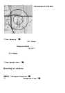
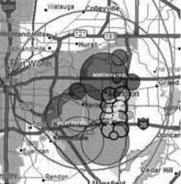
Another Example of Multiple Site
Creation
The geogr aphic area of Arlington,
TX, is separ ate d in to mu ltiple si te
l oca ti ons to ena bl e au tom atic
lockout an d unlock as one move s
fr om area to area.
Non-Radio Location Based GPS Features
When connected to a GPS, you can progr am specific location information which
will trigger an alert from t he sc ann er. The s c anner becomes an extension of the
GPS de vice .
T h e fo l low ing geo gr aphical value s ar e ty pica l of u se you mig ht find val uable while
traveling. Use the menu (begin with Program Location) to input the necessary
data to e na ble ea ch.
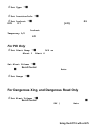
• Dangerous Xing — Stor es location, speed, and direction of travel. If you are in
range, traveli ng greater than the set speed, and moving in the selected
direction, the radio sounds an alert at .5, .25, and .1 mil es (r adius of a circl e)
from the point. These range distances are automatic and fixed.
• Dangerous Road — Stores location, directi on of tr avel, and speed. If you are
tr avel ing at a sp eed gr ea ter than that spec ified, i n the dir ecti on sp eci fi ed, an d i f
yo u a r e wi thin r an ge of the se t l oca tion, th e scanner soun ds an aler t at .5, .25,
and .1 mi l es from the poi nt. T hese range di stances are al so automati c and
fixed.
• Points of Interest ( POI) — Stores location and range. If you approach the set
location, the r adio sounds an alert up to 2 miles from the center.
Press F + [GPS] to choose a setting for Dangerous Xing, Dangerous Road, or
POI.