


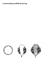
126
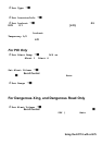
Set Heading F You can inpu t t he co mp ass direct io n to t he sit e from yo ur
p re sen t location or, you can sele ct All Range which ignores y our spec ific
heading.
F or example: If the Dangerous Road location is toward the Northeast and you are
driving in th at direction, the n choo se NE (45°)
I f you know y ou will be driv ing on a road which h as many c urves to that s ite cent er,
choose All Range which will trigger the alert regardless of direc tion as lon g as
the other requirements (range, speed) are met.
If you tr av e l i n a N or the as t d irection an d do n ot tr avel ei ther si d e of a no rthe ast l ine
b y up to 22 degrees, the alert syst em will fun ction.
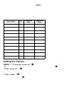
Set Speed Limit F Choose fr om 0, thr o ugh 100 M PH in 5 MPH steps or
the equivalent in KPH for metric usage.
Deleting a Location
If you have programm ed a location that you no l onger want, you can delete it as
follows.
[MENU] Program Location F
Se le ct a location such as Dangerous Xing F
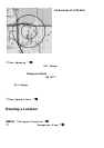
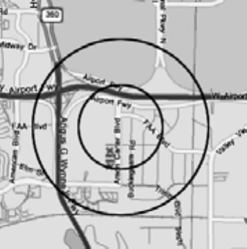
An Example of a POI Alert
The Uniden Am erica Corporation is
l ocated at 4700 Am on Car ter Bl vd
in Ft. Wo rth, TX . The L atitu de an d
Longitude of the front entrance is
32° 50’00.63” N and 97°02’54.16”
W.
When you program that data as a
P OI, yo u can select al ert ra ng es o f
.1, .25, .5, .75, 1.0, 1.5, and 2.0
mile dista nces to the POI. S ho wn
on the map are .5 and 1.0 mile
marke rs.
You are alerted when you come
within range of your set distances.