


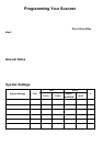
76
This se tt in g cont rol wh et her the system is auto mat ically en abled an d disable d
when you conn ect a GPS to the scanne r.
S et L atitude — En ter the syste m’s latitud e using t he f ormat you se le ct ed in the
system sett in gs.
S et L on gitude — E nter the syst em’s longit ude using the format yo u sele ct ed in the
system sett in gs.
S et Ran ge — S et t he system’s ra nge using t he unit s you se le ct ed in the syste m
settings.
Se t GPS Enable — L/O status is automatically co ntrolle d b y rece ivin g d ata fro m
GPS.
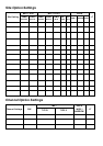
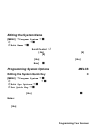
[MENU] Program System F
Se le ct a M ot oro la Type I syst em F
Edit Sys Option F
Edit Fleet Map F
Preset — se lect f ro m the 16 most common fleet maps
Custom — allows yo u to enter a cu stom fle et ma p. Ente r the si ze cod e ( 0 to 14)
for ea ch block. Pre ss F to se lect .
For M ot orola Type I systems, you must e nte r a system fleet map in order f or the
sc anner to properl y tr ack and dis pl ay talk group ID ’ s. The fleet map is usual ly
include d in the same re sou rce that provided system f re qu encie s an d ta lk gr ou p I D
lists.
Note: If you don’t kn ow the f le et ma p for you r Mo toro la Typ e I system, che ck a
re sou rce o n the Int er ne t su ch as www.r adioreference .com or refer ence w eb si tes in
thi s m anual.
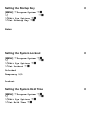
[MENU] Program System F
Se le ct a M ot oro la Type I or II syst em F
Edit Sys Option F
Set Status Bit F
Ignore — the scanne r roun d s a ll received ID’s d o wn to the next inte rval of 16 .
The defau lt s etting is Ignore.
Setting the Fleet Map M (Type I Only)
Setting the Status Bit M